Color in Middle Tennessee should peak around Nov. 1, so go in the next two weeks. The dry October means the color may be patchier than usual, so don't hold out for the perfect weekend. Here's where we'd go, close to town first, then the day trips worth the drive.
Radnor Lake

The classic. A protected lake and wooded ridges about 20 minutes south of downtown, where the color reflects off the water and the deer don't mind you.
- When to go
- Sunrise on a weekday, for still water and fewer people. The gates open at 6 AM and close 20 minutes after sunset, and the lot fills fast on nice weekends.
- What to do
- The loop around the lake, about 2.6 miles, or Ganier Ridge if you want a climb and a view from above.
- Good to know
- Stay on the trails. Dogs, bikes and jogging are allowed only on paved Otter Creek Road.
Natchez Trace Parkway
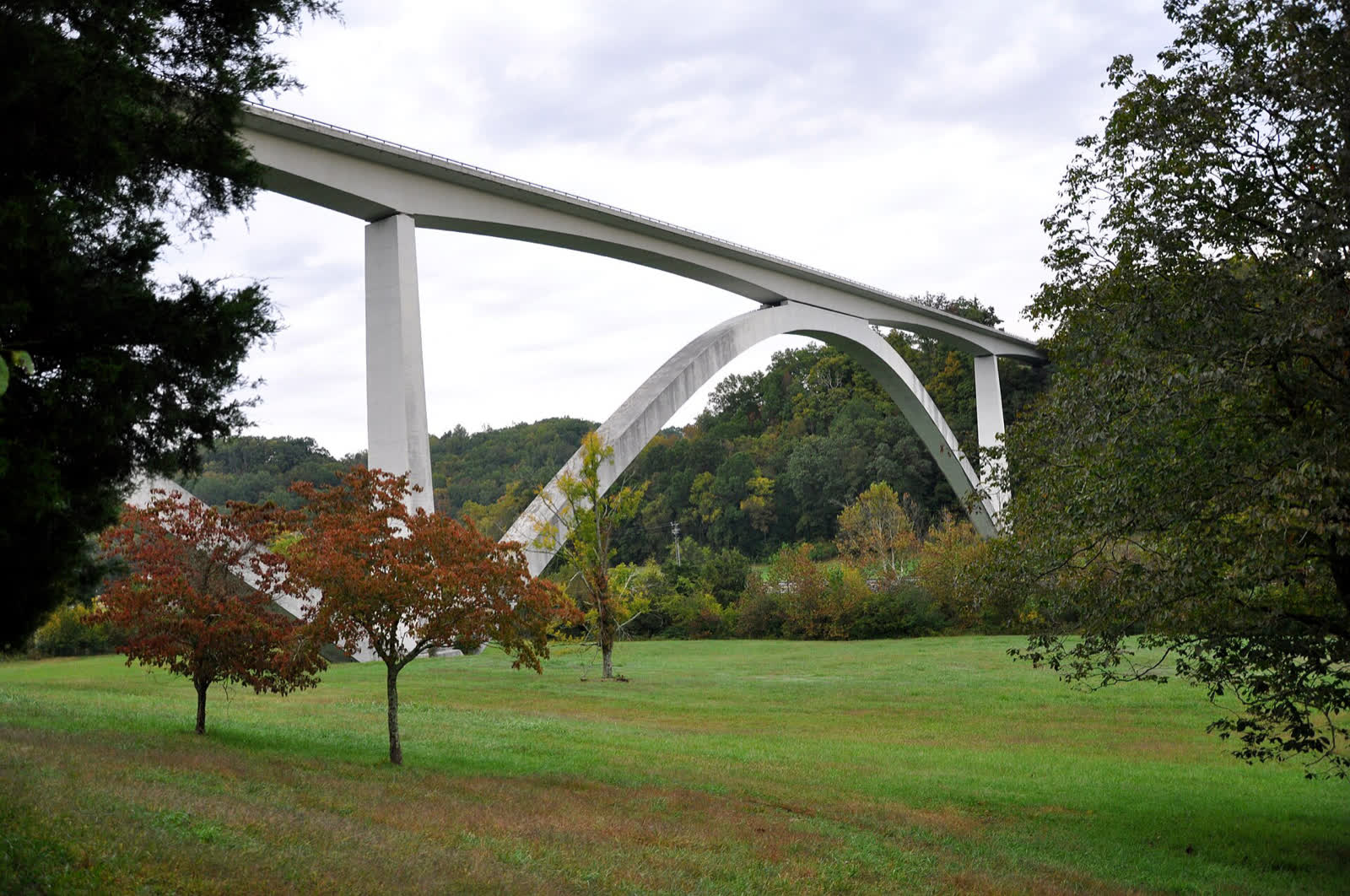
Start at the Double Arch Bridge near Franklin and keep heading south. The parkway has no billboards and no trucks, just two lanes through the trees.
- When to go
- A clear morning, when the light hits the bridge and the hollow below it.
- Local move
- Breakfast first at the Loveless Cafe near the north end, then stop at the overlook just past the bridge for the classic shot. Leiper's Fork is a short detour for lunch.
- Good to know
- The speed limit is 50 mph, and rangers enforce it.
Percy and Edwin Warner Parks
More than 3,100 acres of wooded hills nine miles from downtown, for when you want color without the drive.
- What to do
- Drive the paved loop up to Luke Lea Heights for the best downtown overlook, or walk the 4.5-mile Mossy Ridge Trail.
- Good to know
- Start at the Nature Center on Highway 100 for trail maps.
Burgess Falls State Park
A short hike to a big waterfall in the gorge. The Falling Water River drops over a series of falls, ending in the 136-foot main falls.
- What to do
- The River Trail follows the gorge past the smaller falls to the main overlook, about 1.5 miles round trip, with a steep stretch near the end.
- Good to know
- It's an easy morning trip on I-40 east. Pair it with lunch in Cookeville on the way home. The park can close when the river runs high, so check before you go.
Fall Creek Falls State Park

Overlooks, waterfalls and some of the most varied color in the state, including Fall Creek Falls itself, at 256 feet the tallest waterfall in Tennessee.
- What to do
- Drive the scenic loop and stop at the overlooks. The Fall Creek Falls overlook is a short walk from the lot.
- Good to know
- Check the park's closures before you hike: some trails are still closed after the 2023 tornado. The lodge makes it an easy overnight.
We checked this on Oct. 25, 2026. Color changes by the day, so check Tennessee State Parks for conditions before you drive. Want a full weekend? See our fall weekend guide.